|
COORDINATES ALTITUDE |
ECOSYSTEM TYPE |
EQUIPMENT &MEASUREMENTS |
START |
INSTITUTIONS IN CHARGE |
PROJECTS |
FLUXPYR stations |
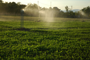
PLA DE RIART
( Spain ) . map |
42° 03' 48" N
1° 30' 48" E
Alt. 1003 m asl |
Cropland
(wheat, barley, vetch) |
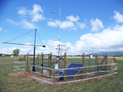
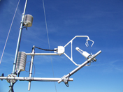
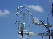
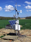
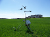
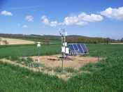
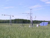
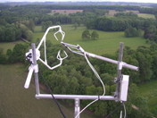
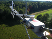
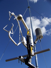
Eddy covariance mast + meteorological station |
2010 |
CTFC - UPC |
FLUXPYR |
|
|
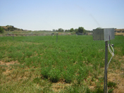
AURADÉ
( France ) . map |
43° 54' 97" N
01° 06' 22" E
Alt. 243 m asl |
Cropland
(wheat, sunflower, rapeseed) |
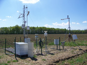
Eddy covariance mast + meteorological station |
2005 |
CESBIO |
Fluxpyr, CarboEurope IP, Ifloz, CarboFrance, MicMac, Design, ICOS, GHG Europe, Vulnoz. |
|
LAMASQUÈRE
( France ) . map |
43° 29' 48" N
1° 14' 15" E
Alt. 181 m asl |
Cropland
(corn, wheat, triticale, sunflower) |
Eddy covariance mast + meteorological station |
2005 |
CESBIO |
Fluxpyr,
CarboEurope IP, Ifloz, CarboFrance, MicMac, Design, ICOS, GHG Europe, Vulnoz.
|
| |
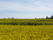
TOUGET
( France ) . map |
43° 40' 13" N
0° 55' 29" E
Alt. 155 m asl |
Cropland
(rapeseed) |
Eddy covariance mast + meteorological station |
2010 |
CESBIO |
Fluxpyr, CarboEurope IP, Ifloz, CarboFrance, MicMac, Design, ICOS, GHG Europe, Vulnoz. |
|
LA MUELA
( Spain ) . map |
41° 13' 50" N
1° 15' 00" E
Alt. 611 m asl |
|
CO2 tall tower
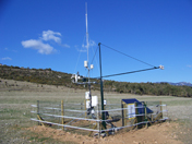
+ meteorological station |
2004 |
IC3 |
FLUXPYR |
|
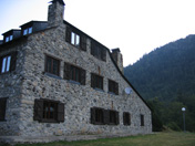
CRAM (Vielha)
( Spain ) . map |
42° 37' 17" N
0° 45' 57" E
Alt. 1630 m asl |
semi-urban |
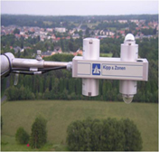
CO2 continuous sensor + meteorological station |
2010 |
CRAM (Centre de Recerca d'Alta Muntanya)
|
FLUXPYR |
|
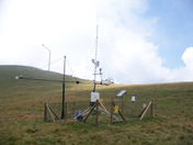
LANNEMEZAN
( France ) . map |
43° 07' 40" N
0° 21' 55" E
Alt. 590 m asl |
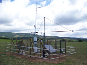
Grassland |
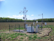
Eddy covariance mast + meteorological station + tall tower |
2010 |
LA, CESBIO |
FLUXPYR |
|
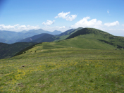
LA BERTOLINA .
(Spain) . map |
42°05'56" N
1°39'40" E,
Alt. 1275 m
asl. |
Grassland
(grazed) |
Eddy covariance mast + meteorological station |
2010 |
CTFC, UPC |
FLUXPYR |
| |
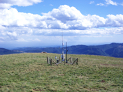
CASTELLAR DE N' HUG
( Spain ) . map |
42°18'18" N
2°02'01" E
Alt. 2000 m asl.
|
Grassland
(grazed) |
Eddy covariance mast + meteorological station |
2010 |
CTFC, UPC |
FLUXPYR |
|
AUZAT-SALEIX
( France ) . map |
42°45'59.98"N 1°28'59.47" E 734 m asl |
Urban |
Radar sensor for flow measurement |
2010 |
GEODE |
FLUXPYR, OHM-CNRS |
AUZAT-VICDESSOS
( France ) . map |
42°45'49.77"N 1°28'56.89" E 732 m asl |
Semi-urban |
Radar sensor for flow measurement |
end of 2010 |
GEODE |
FLUXPYR, OHM-CNRS |
AUZAT-PLA DE L'ISARD
( France ) . map |
42°41'33.18"N 1°27'03.35" E 1254 m asl |
Grassland |
Meteorological station with precipitation and temperature sensors |
2011 |
GEODE |
FLUXPYR, OHM-CNRS |
AUZAT-IZOURT
( France ) . map |
42°41'37.28"N 1°29'54.38" E 1674 m asl |
Grassland |
Meteorological station with precipitation and temperature sensors |
2011 |
GEODE |
FLUXPYR, OHM-CNRS |
|
|
VALLÉE D'EYNE
|
42°30' N
2°03' E |
Grassland |
Tauber traps for short-term pollen rain study (altitudinal gradient) |
2009-2010 |
GEODE |
FLUXPYR, OHM-CNRS |
VALLÉE DE BASSIÈS
|
42°45' N
1°25' E |
Grassland |
To be carried out.
Tauber traps for short-term pollen rain study |
2011-2012 |
GEODE |
FLUXPYR, OHM-CNRS |
NÉOUVIELLE
|
42°48' N
0°03' E |
Grassland |
To be carried out.
Tauber traps for short-term pollen rain study |
2011-2012 |
GEODE |
FLUXPYR, OHM-CNRS |
Associated Sites |
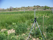
CASTELLNOU D'OSSO
( SPAIN ) . map |
41° 45' 53" N
1° 08' 35" E
Alt. 355 m asl. |
48 plots: grasses, legumes, forbs
|
Ecological surveys + Lysimeters + GHG emissions
|
2009 |
CTFC |
OPS |
|