Integration of experimentation, models and images multiscale as a tool to manage multifunctionality in pastoral mountain systems
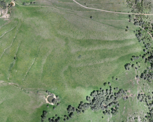
ENG: The project IMAGINE aims at assessing biodiversity and multifunctionality distribution in pastoral ecosystems, currently active or abandoned, at several scales in the context of global change through the analysis of drone and satellite multi-spectral imagery, in combination with other standard and cutting-edge molecular, analytical and modelling techniques. The increasing capability to capture and process ecological images at multiple scales (regional, landscape, ecosystem, soil) is changing our understanding about ecosystem dynamics and the relationship between ecosystem patterns and processes, including the role of biodiversity on multiple ecosystem functions (multifunctionality). In addition, the application of molecular techniques in ecological studies are revealing the fundamental role of soil diversity and function in interaction with plants and other organisms on ecosystem service provisioning. The combination of those techniques constitutes a powerful tool for the understanding of the role of biodiversity on the carbon and nutrient cycles under climate change, including greenhouse gas emissions, and for the management of agro-pastoral and forest ecosystems under global changes, including prescribed burns. Based on the multidisciplinary expertise of the research group and an existing body of information gathered in previous projects, we select three areas within the Western Mediterranean region -Western Pyrenees, Eastern Pyrenees and Montseny- to assess the vulnerability of climatically contrasted Mediterranean mountains to global change factors, including climate and management changes, and abandonment. Data within IMAGINE will feed regional studies in EU projects by members of the scientific team. At landscape scales, the project proposes the mapping of several ecosystem services, including wildfire regulation, quality forage provisioning and biodiversity conservation. At ecosystem and intra-ecosystem scales, IMAGINE proposes the combination of imaging with analytic and molecular techniques to increase our understanding about the mechanistic processes behind ecosystem service provisioning, including ecological interactions of biological diversity with the environment, and among organisms at different taxonomic levels.
CAT: El projecte IMAGINE té com a objectiu avaluar la distribució de la biodiversitat i la multifuncionalitat en ecosistemes pastorals, actualment actius o abandonats, a diverses escales en el context del canvi global mitjançant l’anàlisi d’imatges multiespectrals de drons i satèl·lits, en combinació amb altres tècniques moleculars, analítiques i de modelatge estàndard i d’avantguarda. La capacitat creixent per capturar i processar imatges ecològiques a múltiples escales (regional, paisatge, ecosistema, sòl) està canviant la nostra comprensió sobre la dinàmica dels ecosistemes i la relació entre patrons i processos ecosistèmics, incloent-hi el paper de la biodiversitat en múltiples funcions ecosistèmiques (multifuncionalitat). A més, l’aplicació de tècniques moleculars en estudis ecològics està revelant el paper fonamental de la diversitat i funció del sòl en interacció amb plantes i altres organismes en la provisió de serveis ecosistèmics. La combinació d’aquestes tècniques constitueix una eina poderosa per entendre el paper de la biodiversitat en els cicles del carboni i dels nutrients sota el canvi climàtic, incloent-hi les emissions de gasos d’efecte hivernacle, i per a la gestió d’ecosistemes agro-pastorals i forestals sota els canvis globals, incloent-hi les cremades prescrites. Basant-se en l’expertesa multidisciplinària del grup de recerca i un cos d’informació existent recollit en projectes anteriors, seleccionem tres àrees dins de la regió del Mediterrani occidental -Pirineus occidentals, Pirineus orientals i Montseny- per avaluar la vulnerabilitat de muntanyes mediterrànies amb contrastos climàtics als factors de canvi global, incloent-hi els canvis climàtics i de gestió, i l’abandonament. Les dades dins d’IMAGINE alimentaran estudis regionals en projectes de la UE per part dels membres de l’equip científic. A escales de paisatge, el projecte proposa el mapatge de diversos serveis ecosistèmics, incloent-hi la regulació dels incendis forestals, la provisió de farratge de qualitat i la conservació de la biodiversitat. A escales d’ecosistema i intraecosistema, IMAGINE proposa la combinació d’imatgeria amb tècniques analítiques i moleculars per augmentar la nostra comprensió sobre els processos mecanicistes darrere de la provisió de serveis ecosistèmics, incloent-hi les interaccions ecològiques de la diversitat biològica amb l’entorn i entre organismes a diferents nivells taxonòmics.
Selected publications
Marí, T., Castaño, C., Rodríguez, A., Ibáñez, M., Lobo, A., Sebastià, M.T., 2020. Fairy rings harbor distinct soil fungal communities and high fungal diversity in a montane grassland. Fungal Ecol. 47, 100962. https://doi.org/10.1016/j.funeco.2020.100962
Ibañez, M., Altimir, N., Ribas, À., Eugster, W., Sebastia, M.T., 2020. Cereal-legume mixtures increase net CO2 uptake in a forage system of the Eastern Pyrenees. Biogeosciences Discuss. 1–30. https://doi.org/10.5194/bg-2020-173
Debouk, H., Emeterio, L.S., Marí, T., Canals, R.M., Sebastià, M.T., 2020. Plant functional diversity, climate and grazer type regulate soil activity in natural grasslands. Agronomy 10, 1291, 1–20. https://doi.org/10.3390/agronomy10091291
Codi del projecte: CGL2017-85490-R
Finançament: 205.700 €
Durada del projecte: 2018-2021
Entitat finançadora: Programa Nacional de Biodiversidad, Ciencias de la Tierra y Cambio Global (CGL). Ministerio de Economía y Competitividad